A new section of the CottonInfo website provides biodiversity information for every Local Government Area (LGA) in Australian cotton growing regions.
The information included for each LGA includes:
- Relative areas – Area of cotton landscape; Area of remnant vegetation in the cotton landscape; Area of threatened ecological communities in the cotton landscape; and Area of priority zones for native vegetation restoration and enhancement
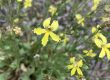
- Vegetation – Main vegetation types on cotton properties; and Main threatened ecological communities on cotton properties
- Wetlands and rivers – Named wetlands in the cotton landscape; Area of wetlands in the cotton landscape; Length of major rivers in the cotton landscape; Length of minor water courses in the cotton landscape
- Public land – Area of national park in the cotton landscape; Area of travelling stock routes in the cotton landscape; Area of state forests in the cotton landscape
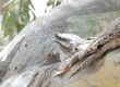
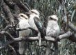
- Threatened species (plants and animals) – Examples of iconic species in the cotton landscape; Examples of threatened species in the cotton landscape
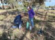
Each LGA also has a list of general management actions, along with priority management actions for that region.
This biodiversity data for cotton growing regions has been collated to help understand and prioritise the conservation value of areas of native vegetation within cotton landscapes (cotton farms plus a 5km buffer). It has also identified priority areas and management actions to help restore these areas for the benefit of threatened and iconic species.
View the searchable map and associated information on the CottonInfo website.